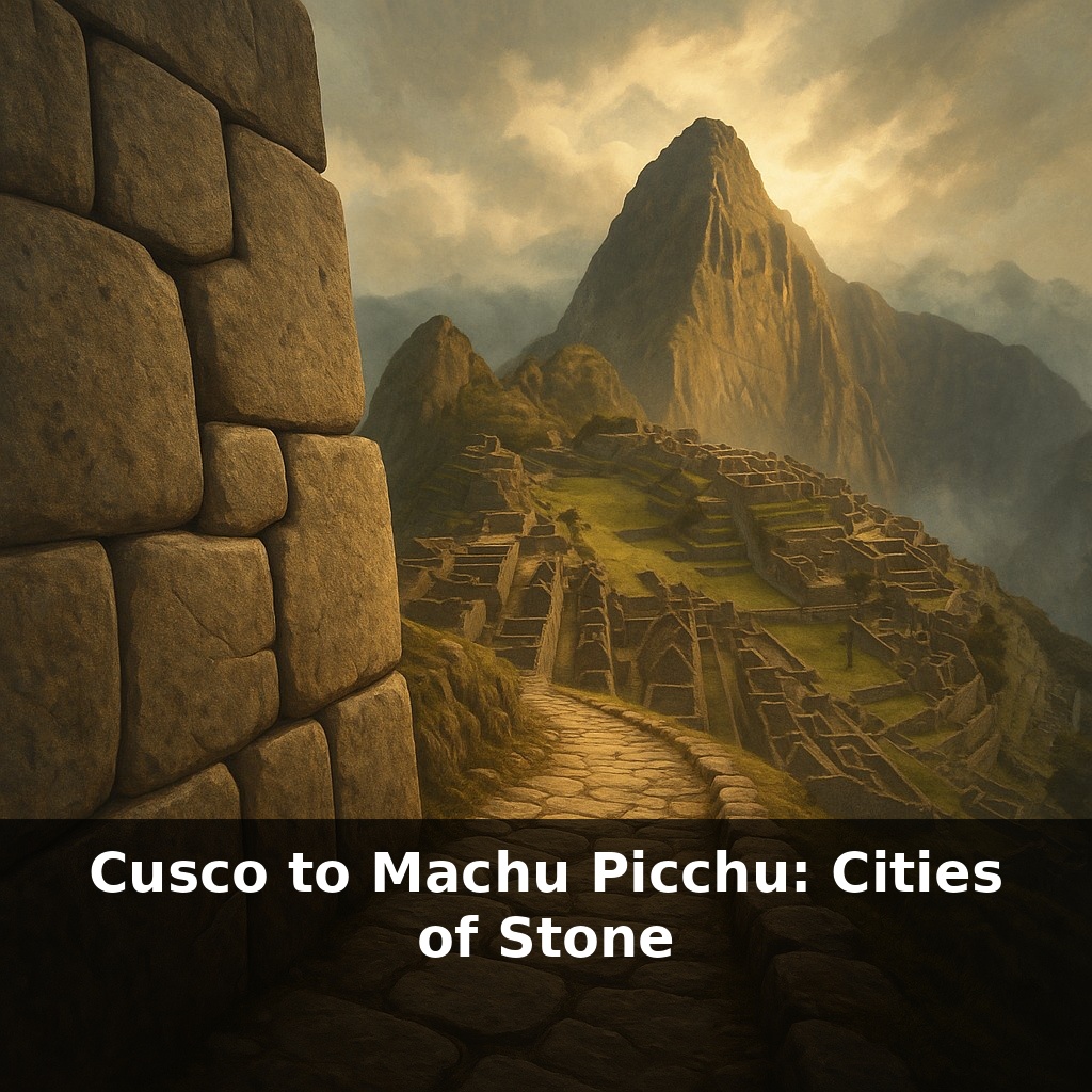
Stones that can “dance” through earthquakes without collapsing. A city in the clouds where most of the work is hidden underground. And a civilization that shaped rock so precisely, a knife blade can’t slip between blocks. We’re heading from Cusco to Machu Picchu, along a road of stone.
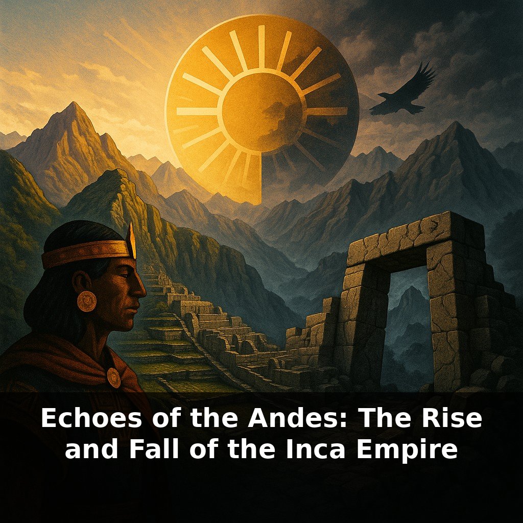
Cusco and Machu Picchu were not just built *on* mountains; they were engineered to behave like part of the mountain itself. That’s the real secret behind those “dancing” stones and that city in the clouds. Inca planners treated every slope, spring and fracture in the bedrock as non‑negotiable data, the way a careful coder treats system limits—not as annoyances, but as the rules that make the whole program run. Cusco became a kind of stone archive of imperial power, laid out in the shape of a puma, while Machu Picchu functioned more like a laboratory: smaller, more secluded, but packed with experiments in farming, water control and astronomy. Between them runs not just a road, but a chain of waystations, shrines and sightlines that turned walking through the landscape into moving through a designed, imperial story.
To follow that stone road from Cusco to Machu Picchu, you have to think in layers. On the surface, you see plazas, temples and terraces. Underneath, there’s an invisible architecture of drains, foundations and carved channels quietly steering water and weight. High above, alignments to solstices and sacred peaks knit these sites into the sky. And stretched between them is an equally deliberate human network: messengers running the Qhapaq Ñan road, farmers testing crops at different altitudes, ritual specialists timing ceremonies to seasonal shifts. We’re stepping into a system where geology, climate and belief are co‑authors of every wall.
Stand in Cusco’s historic center and look down instead of up. Many “Spanish” buildings sit on older Inca foundations: perfectly cut walls at the base, rougher colonial masonry stacked on top. It’s a vertical timeline in stone. When earthquakes hit, those lower Inca courses usually stay put while the newer layers crack. The empire’s engineering is literally still carrying the city.
Follow that logic uphill to Sacsayhuamán, the vast zig‑zag fortress above Cusco. Each angle of its walls forces an attacker to expose their side as they advance, turning the whole complex into a three‑dimensional trap. The huge stones—some the size of buses—aren’t just about showing off. Their irregular shapes, varied sizes and interlocking faces distribute stress so no single block takes the full hit from earth tremors or enemy blows.
Now shift to the road system that once linked Cusco to sites like Machu Picchu. The Inca didn’t pave straight lines across the Andes; they stitched paths along natural contours, cutting steps into rock faces and suspending rope bridges over ravines. Relay runners (chaskis) used these routes to move messages and goods with stunning speed. You can still walk segments of this network today and feel how carefully each turn responds to slope and soil.
Arriving at Machu Picchu, the first surprise is how small the central cluster of temples and houses feels compared to the sweeping terraces. Those green steps are not decorative. They stabilize the mountain, trap thin Andean soils, and create microclimates: warmer niches for maize, cooler pockets for potatoes, testing what could grow where. Beneath them lies a thick skeleton of gravel, retaining walls and stone‑lined drains channeling rainfall down and away.
Astronomy threads through all of this. The Torreón’s curved wall frames June solstice light; the Intihuatana stone casts shadows that mark seasonal shifts used to time planting and ritual. Yet these aren’t isolated observatories. They’re plugged into the broader Andean habit of reading mountains, water and sky as one continuous system—where a crack in bedrock might be both a structural concern and a sacred sign.
The result is a pair of cities that don’t fight their landscape; they negotiate with it, stone by stone.
Think about how differently weight and force move through these places compared to a typical modern city. In many downtowns, you’ve got rigid concrete frames pushing loads straight down into deep foundations, often ignoring subtle variations in the ground. In Cusco and Machu Picchu, load paths bend, split and rejoin as stones “read” the bedrock below. A single terrace wall might quietly pass pressure sideways into three or four neighbors.
To see the logic in action, watch how steps change under your feet on Inca trails: shallow and wide on gentler slopes where people and llamas shared space; narrower and steeper in cliff sections to shorten the distance and shed water faster. At certain passes, small viewing platforms sit just off the main route, less as scenic overlooks for us than as checkpoints where officials could scan valleys and track movement.
Your challenge this week: study how your own city handles weight and water. Notice where hills have been shaved flat, where drains clog after storms, where old bridges flex more than new ones. Then, ask yourself: what would an Inca engineer have done with this same patch of ground?
Future Implications: As LiDAR and digital twins turn Cusco and Machu Picchu into navigable data sets, architects can stress‑test low‑carbon stone systems the way coders debug software. Seismic‑isolating joints, gravity‑fed water grids and tiered landscapes could migrate from heritage sites into codes for hillside housing from Kathmandu to La Paz. The ethical fault line: who profits if Andean knowledge becomes the open‑source backbone of tomorrow’s mountain cities?
Today’s engineers still go to Cusco and Machu Picchu like programmers reading legacy code: not to copy it line by line, but to steal its logic for new terrains, new climates. The real frontier isn’t taller skyscrapers; it’s learning to stack stone, steel and policy so cities flex, drain and adapt as gracefully as those old Andean scripts.
To go deeper, here are 3 next steps: 1) Open Google Earth and use the “Voyager” feature to virtually trace the route from Cusco through the Sacred Valley to Machu Picchu, pausing to compare what you see with photos and maps from Peru’s official tourism site (peru.travel). 2) Watch the documentary “City of the Inca” episode from the PBS *Nova* series or the National Geographic special on Machu Picchu, then jot down 3 engineering or architectural details (like terrace construction or water channels) you’d want to look for if you were standing there in person. 3) Grab a copy of Mark Adams’ *Turn Right at Machu Picchu* (ebook or audiobook), and today read or listen to the first chapter while following along on an online topographic map of the Urubamba Valley so you can connect his journey step‑by‑step with the actual landscape.