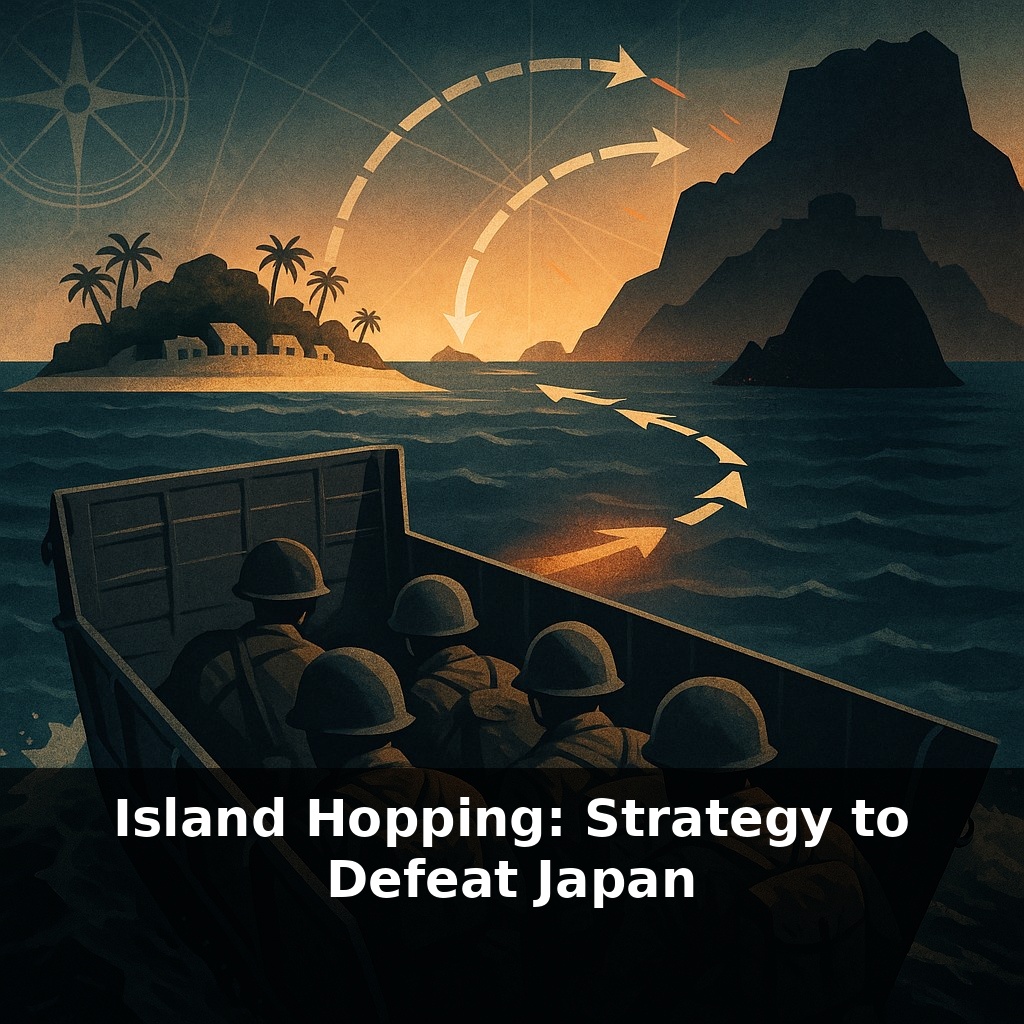
A million soldiers went to war on Pacific islands they were never meant to escape from. In this episode, we drop into a landing craft under fire, then pull back to ask: how do you fight an empire built on islands—without bleeding for every grain of sand?
Fewer than one in four major Pacific landings hit Japan’s strongest island fortresses. The rest aimed for something less obvious—and far more important. Allied planners began asking a different question, not “How do we take this island?” but “What happens if we leave it behind?” Radar ranges, airstrip lengths, fuel limits, and shipping routes turned into the real battlefield. A coral atoll with room for a runway might matter more than a famous bastion bristling with guns. Some islands became crucial stepping stones; others, expensively armed dead ends. This shift in thinking quietly rewrote the map of the war. In this episode, we’ll trace how that map changed: from Rabaul—too costly to storm, too dangerous to ignore—to the Marianas, where new airfields would bring Tokyo into reach and start the clock on Japan’s defeat.
Some of the boldest moves came from what commanders *refused* to do. Rather than chase every Japanese flag on the map, they traced fuel arcs from carriers, bomber ranges from future runways, and shipping lanes feeding Japan’s armies. Certain islands glowed on these charts like storm fronts shaping the whole region, while others faded to background weather—unpleasant, but no longer decisive. Operations like Cartwheel turned this math into action, sealing off Rabaul. Next came a harder puzzle: how few strikes—and where—could collapse an entire defensive system without battering every strongpoint in it?
The first place this new logic was tested was in blood. At Tarawa in late 1943, Marines crossed a narrow reef under direct fire and lost around a thousand men in just over three days. The island was tiny, the victory clear—and yet the price was so shocking that one question kept coming back in after‑action reports: was this strip of sand truly the *cheapest* way forward?
Senior commanders began pushing their staff to redraw options. Instead of a single track of successive conquests, they laid out multiple possible paths and asked: which route forces Japan to waste the most strength in the wrong places? Which captured positions would let Allied air and sea power overlap, so that each new foothold strengthened the next? The results produced two broad thrusts: Nimitz driving through the Central Pacific, and MacArthur advancing along New Guinea toward the Philippines.
Operation Cartwheel showed what this could look like in practice. Rather than crash straight into Rabaul, Allied forces advanced on its surrounding satellites—New Georgia, Bougainville, and others—securing positions just close enough for bombers and patrol aircraft to bite into Rabaul’s lifelines. Australian troops and aircrews were central here, slowly turning the base into a trap for its own garrison. By early 1944, Rabaul was still heavily armed, but its planes were short on fuel and its ships rarely dared to move.
Further north and west, the same pattern repeated with higher stakes. Capturing the Marshalls opened routes to the Marianas; taking Saipan and Tinian unlocked long‑range strikes that bypassed intermediate strongpoints altogether. Each successful landing forced Tokyo to confront an uncomfortable math problem: thousands of soldiers sat on remote islands that no longer influenced the campaign but still had to be fed, supplied, and occasionally reinforced.
This was not a clean process. Some “lightly held” objectives turned out to be more stubborn than expected; others cost fewer lives than feared. Japanese commanders, trained to hold ground at all costs, often fought to annihilation even when cut off. That rigidity helped the island‑hopping concept work. The more Tokyo insisted every outpost was sacred, the easier it became for Allied planners to turn them into isolated pockets—fixed shapes in a tide that was steadily moving on.
Think of Allied planners like meteorologists watching a vast weather map rather than chess players obsessing over a single piece. They studied where “pressure systems” of fuel, food, and ammunition were building or collapsing, then aimed operations at those invisible fronts. One example: once Saipan and Tinian were secured, engineers carved out massive runways and fuel farms in months, turning quiet islands into logistical “high‑pressure zones” that pushed bomber and submarine power far beyond their shorelines. At the same time, bypassed garrisons became like stalled storms, dangerous close‑up but no longer steering events. In 1945, thousands of Japanese troops sat on Truk, Wake, and other cut‑off positions, armed but strategically silent. Submarines amplified this effect, prowling the sea lanes and shredding merchant convoys that tried to keep those outposts alive. The real story wasn’t just which flag flew over which island, but whose supply “weather” was clearing and whose was spiraling into permanent storm.
Island‑hopping also hints at how power may work in a world of long‑range sensors, cyber tools, and autonomous systems. Future forces might disperse like a shifting archipelago of nodes—some visible, some “dark”—that pass targeting data and resources the way currents move through the sea. Instead of seizing ground, states could focus on quietly denying key routes, nudging rivals into defending empty space while influence flows along quieter channels in the background.
Island‑hopping leaves us with a puzzle that still matters: in any struggle, where is the *real* center of gravity hiding? In a supply hub, a shipping lane, a data cable no one notices? Like a tide sneaking past a castle’s walls, power can flow around what looks strongest. The hard part—then and now—is daring to leave some impressive targets alone.
To go deeper, here are 3 next steps: (1) Watch the free “Island Hopping in the Pacific” lecture segment from The Great Courses (often on Kanopy or your library’s streaming service) and follow along with a Pacific map open on the U.S. Naval War College’s online “Pacific Theater WWII” map to trace each major island taken (Guadalcanal, Tarawa, Saipan, Iwo Jima, Okinawa). (2) Read the chapter on the Central Pacific drive in Ian Toll’s *Pacific Crucible* or *The Conquering Tide*, then pause to compare his description of bypassing Rabaul with what was said in the episode about isolating strongpoints instead of storming them. (3) Open the “HyperWar: US Army in WWII – The War in the Pacific” archive online and pick one specific campaign mentioned in the episode (for example, “Guadalcanal: The First Offensive”), then skim the official after-action sections to see how logistics, airfields, and naval support were actually planned and executed in an island-hopping operation.