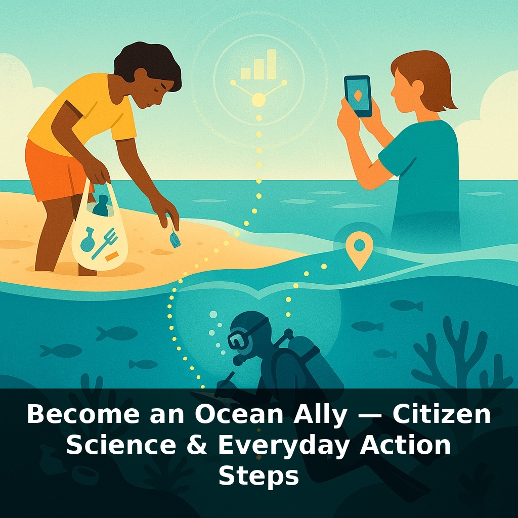
An ordinary beachgoer, a scuba club, and a kid with a smartphone once helped trigger a coral-reef closure—without meeting, or even knowing it. Their photos, litter counts, and dive notes flowed into the same database… and quietly rewrote an entire region’s ocean policy.
221,589 people bending down to pick up trash in a single year doesn’t sound like a revolution. But when each of them logged every bottle cap, cigarette butt, and plastic fork, they built an evidence trail powerful enough to shape laws. That’s the quiet shift underway: ocean science is no longer something that only happens on research vessels. It’s happening on beaches, docks, dive boats, and living-room couches—anywhere a phone, notebook, or laptop can travel.
This episode is about that shift from bystander to Ocean Ally. Not by quitting your job to become a marine biologist, but by weaving the ocean into things you already do: what you eat, how you travel, the photos you take, and even the apps you tap while waiting for a bus. Together, those tiny signals add up to something experts can’t get any other way: a living, global snapshot of a changing sea.
Those snapshots and notes don’t just sit in an app; they ripple outward. When thousands of beach-litter records appear along one stretch of coast, lawmakers suddenly have numbers to back bans on specific items. When divers consistently log bleaching at a favorite reef, managers can time temporary closures with the precision of a seasoned chef pulling a dish from the oven at the exact moment it’s done. And when inland communities track plastic in rivers and storm drains, they help cut off pollution before it even has the chance to reach saltwater.
You can see this shift most clearly in the places professionals can’t easily go, or can’t visit often enough. Coral-reef scientists might get a week of ship time each year; local dive clubs can slip into the same cove every Saturday. A researcher might survey a coastline once a season; runners, dog-walkers, and surfers notice when a new kind of trash starts showing up and log it that same day.
This “many small visits” pattern is powerful. In one study, Cooper and colleagues compared trained volunteers counting reef fish with professional survey teams. The result: citizen data tracked formal surveys within about five percent for key indicators like coral cover and fish abundance—close enough to feed directly into models and management plans. That level of agreement doesn’t happen by accident. Projects like Reef Check and the International Coastal Cleanup use clear methods, simple field guides, and quick online trainings so your notes line up with thousands of others.
What you choose to record depends on your life, not your latitude. Live near a pier? You might snap smartphone photos of jellyfish swarms or algal blooms and upload them to an open platform. Dive or snorkel? You can log which reef fish you see, or note bleaching and disease. Far from the coast? Some projects ask you to listen to short clips from undersea microphones and tag whale songs, ship noise, or snapping shrimp. Others turn your grocery run into data: you can scan barcodes or enter seafood labels into apps that track what species people are really buying, and whether they’re certified as sustainable.
These observations don’t just describe the ocean; they link directly to action. When Global Fishing Watch overlays satellite tracks with suspicious port visits flagged by locals, authorities get leads on illegal fishing. When inland communities report blocked storm drains and litter hotspots, city crews can target cleanups and infrastructure upgrades that stop trash long before it hits the tide. Step by step, your phone becomes less of a distraction and more of an instrument—quietly adding your vantage point to a shared, planetary field log.
A good way to think about your role is less “helper” and more “missing puzzle piece.” Scientists might know the shape of the coastline, but you’re the one spotting which pieces actually click together on the ground. A kayak club, for instance, can log jellyfish booms along their usual route week after week. Overlayed with temperature data, those notes can reveal early marine heatwaves months before official reports catch up. A parent walking kids to school can snap storm-drain photos after heavy rain; combined with others along the same watershed, those images can pinpoint where new trash-capture nets or street-sweeping schedules would do the most good. Even your supermarket habits matter: if thousands of shoppers quietly shift away from overfished species and log alternatives in a seafood-rating app, that demand signal shows up in purchasing data, nudging suppliers toward better options. None of this feels dramatic in the moment—but slow, steady, locally grounded signals are exactly what most ocean models still lack.
Your photos, sound clips, and notes won’t just sit in a database; they’ll increasingly steer how we adapt. As cheap eDNA “dip-sticks” spread, a kid sampling a city dock could reveal a rare seahorse as casually as testing pool water. AI will sift millions of uploads like a hyper-fast weather report for the sea, flagging odd patterns while they’re still fixable. And when big offshore projects are proposed, organized community records will speak as loudly in hearings as expert slides.
Your challenge this week: Pick one marine project from a local organization or online platform, such as logging marine life via iNaturalist or contributing data to a global ocean survey. Engage with it daily—during your commute, a meal, or a quick break. By the end of the week, share your observations with a local community or online forum to ensure your insights contribute to greater ocean awareness.